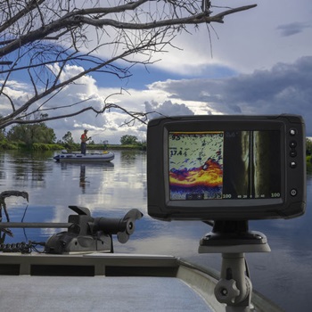
What are the best marine GPS chartplotters out there? Check out our guide to find out whether this type of device might assist you in your boating endeavors. We will take you through all of the things that you might want to know about these units.
If, on the other hand, you’ve been trying to find a good one and you haven’t had a lot of luck up until now, feel free to check out the marine GPS reviews showcased below. These are all products that have acquired a lot of enthusiasm on the part of those that have tried them in the past.
See The Quick Comparison Chart
Benefits of Marine GPS Chartplotters
As you might have noticed if you have taken the time to read some of our reviews, some of these devices tend to cost a pretty penny. You will obviously ask yourself whether it makes sense for you to invest in such a product. Well, let’s look at some of the reasons why you should consider doing just that and the benefits that a chartplotter can provide you with.
1. Never Lose Your Way
One of the most significant benefits that you will get to enjoy if you decide to get a marine GPS chartplotter is the reassurance that you will always get back home. This type of device will provide you with all the maps and navigation features that you need to make your way around even in inclement weather, for example.
You can conveniently, easily, and quickly find and store your top favorite waypoints, and you can also get maps of various water surfaces across the world. These can range from large lakes and channels to actual oceanside areas. Plus, you can customize the device so that it addresses your specific watercraft.
2. Fishing Done Right
 One of the coolest things about marine GPS chartplotters is that most of them come with an integrated fishfinder. This means that you can visualize a variety of data that can help you take your angling to a whole new level so that you bring home trophy catches.
3. Dependable and Durable
As you can expect, this type of device can be exposed to a wide range of contaminants and things that can damage it over time. These can consist of salt water, high or low temperatures, UV damage, and that’s just to name a few. That is why the vast majority of products in this particular line are made to be rugged and stand the abuse of all of these factors.
If you take the time to look at the description of most of the models that we’ve included in our selection, you will find that they are durable, lightweight enough to be able to be handled conveniently, and also waterproof.
4. Relevant Info
The information that can be shown on a marine GPS chartplotter’s screen is truly unparalleled. When it comes to versatility, these devices are net winners as they can inform you with regard to things such as the water temperature, the air temperature, your boat’s speed and the depth the transducer is located at.
On top of everything, a typical chartplotter is equipped with a sonar or radar, and these will help you do your fishing and navigate through friendly or unfriendly waters. Some even come with side imaging.
5. Connectivity
While some anglers might argue that this isn’t the most useful characteristic ever to have been featured in a marine GPS chartplotter, the fact of the matter is that connectivity matters a lot. Being able to connect your device to your smartphone can allow you to keep track of what other boaters are doing, for instance.
It can also give your family and friends some peace of mind that you are doing alright. Last, but not least, in case you need rescuing, they will also know where to come and pick you up — and that’s not something to ignore.
Best Marine GPS Chartplotters Comparison Chart
| PRODUCT | DETAILS | ||
|---|---|---|---|
 | Humminbird 410210-1 HELIX 5 CHIRP GPS G2 Fish Finder |
| View On Amazon |
 | Garmin GPSMAP 78sc Waterproof Marine GPS and Chartplotter |
| View On Amazon |
 | Simrad Cruise-7 Chart Plotter with 7-Inch Screen & US Coastal Maps |
| View On Amazon |
 | Garmin Striker 4 with Transducer, 3.5” GPS Fishfinder with CHIRP |
| View On Amazon |
 | Humminbird 410940-1 HELIX 7 CHIRP MDI GPS G3 Fish Finder |
| View On Amazon |
Best Marine Chartplotter Reviews
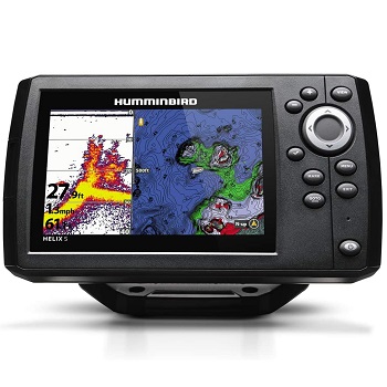
1. Humminbird 410210-1 HELIX 5 CHIRP GPS G2 Fish Finder
If you are in the market for a model that can meet and even exceed your expectations, this Humminbird one should be at the top of your list. It comes with all of the essential features that you might ever need in a GPS chartplotter. It has a sizable 5-inch display, an internal GPS receiver, keypad control, as well as a built-in base map.
There shouldn’t be anything stopping you from using the CHIRP digital sonar that it comes with, which works at a 83-kHz frequency. As for the actual navigational capabilities of this unit, you’ll be glad to know that it comes with internal GPS chart plotting and it has built-in Anima cartography.
Moreover, the SD card slot will allow you to store additional maps, as well as save your waypoints and favorite routes. When it comes to the feedback that this device has received, we couldn’t help noticing that it is quite favorable. People describe it as being awesome for ice fishing, for example.
Pros
- Very easy to operate, even by less tech-savvy people
- Comes with every feature you might need
- You can use the card slot to add maps
- Allows you to make lots of little tweaks when fishing is slow
Cons
- It doesn’t include a screen cover
- Some of the clips might be a little flimsy, so make sure that you fasten it to your boat securely
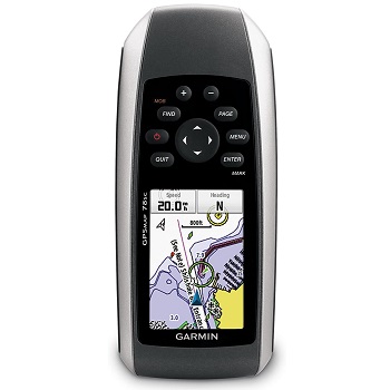
2. Garmin GPSMAP 78sc Waterproof Marine GPS and Chartplotter
Even though it doesn’t take the cake when it comes to its display size, this GPS is definitely a model that you ought to keep in mind. It’s fully waterproof and rugged, so it has a good chance of standing the test of time, but also the abuse of the elements. It’s convenient, easy to use, and portable.
In case you drop it in the water, you will literally see it floating, which means that you will be able to get your hands back on it in a timely fashion. Having been designed with excellent sensitivity, the device provides a clear viewing of all of the maps. It comes with a 2.6-inch TFT color screen, which might not be enough for some people, but it’s very reliable.
What’s also worth noting about this unit is that it is equipped with a barometer, as well as a 3-axis tilted compass.
Pros
- Built-in BlueChart G2 US coastal mapping and charts
- Convenient size and easy-to-use design
- 20 hours of battery life
- Preloaded with thousands of charts
- Waterproof to IPX7 standards
Cons
- The size of the display is pretty much the only drawback that has been reported by some consumers.
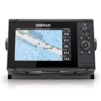
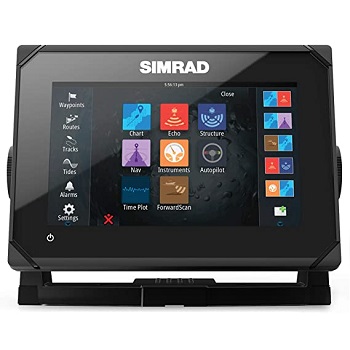
3. Simrad Cruise-7 Chart Plotter with 7-Inch Screen & US Coastal Maps
Even though it is considerably more affordable compared to some of the other models that we have come across, this Simrad unit is definitely worthy of your consideration. It comes with pretty much all of the characteristics that you might need. It even includes a double-frequency transducer for when you fish either in shallow or deep waters.
As one of the easiest to use, most intuitive chartplotters currently available, the Cruise-7 device enables you to benefit from straightforward GPS navigation. Both the sonar transducer and the mounting bracket are included in the box, so you needn’t worry about anything in this sense.
Additionally, the model comes with US coastal charts, but we haven’t found any info according to which it includes maps from other parts of the world, too. However, you can load those separately, if that’s what you need.
A huge number of those that have invested in this model say that it is remarkably easy to utilize.
Pros
- User-friendly interface
- Comes with everything you need right out of the box
- Stock-loaded charts are very accurate
- Provides you with all the navigational information you might need
- Includes double-frequency transducer
Cons
- Might be a little expensive for beginning fishers
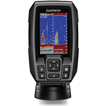
4. Garmin Striker 4 with Transducer, 3.5” GPS Fishfinder with CHIRP
While it is not the most typical chartplotter you might want to opt for, the fact is that the Striker 4 is among the best and most capable fish finders with GPS out there. It boasts a Clear Vu scanning sonar which shows you more of what’s in the water and around your watercraft.
The sonar is high-frequency and gives you almost photographic depictions of the water environment. Like some of the other models in our selection, this one is waterproof to IPX7 standards, meaning that it’s going to do well even in inclement weather. It’s also easy to utilize and install and it comes with the ability of you setting waypoints.
As for the CHIRP Sonar, it sends continuous sweeps of frequencies, and that’s why it is capable of showing you accurate and updated data. It also creates crisp fish arches and superior target separation, so it can even take your angling to a completely different level.
Pros
- Comfortable and convenient keypad operation
- Mark docks, hot spots, and ramps
- Finds fish and displays them quickly and accurately
- Easy-to-use interface
Cons
- If we could improve something about this unit, it would have to be the display as it measures just 1.9 inches by 1.9 inches.
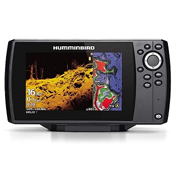
5. Humminbird 410940-1 HELIX 7 CHIRP MDI GPS G3 Fish Finder
Even if you might be a little put off by the cost of this GPS chartplotter, we say that it is worth investing in, especially if you want a high-end device that actually does what it’s supposed to. First of all, it is equipped with a large display that you will use for navigation and fishing, too. The color TFT display will be extremely helpful in localizing your targets, consulting your maps, or setting your waypoints.
With the Low Q CHIRP transducer that this model is outfitted with, you will get two ways to search — a wide one for maximum coverage and a more narrow one for the greatest amount of detail.
It’s also worth noting that you can add or remove detail and check out information such as the temperature and turbulence of the water or the depth your transducer is at. You can even look at lure presentations.
Pros
- Includes everything you need in the box, from the transducer to the mounting hardware
- Lakemaster-compatible
- Highlighted depth ranges, easy to read contours and scrollable lake lists
- Shows fish as well-defined arches
Cons
- Doesn’t come with a screen cover
- It can be more or less difficult to get in touch with the brand’s customer service.
6. HOOK2 9 – 9-inch Fish Finder with TripleShot Transducer
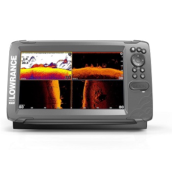 The Lowrance Hook2 is among those units capable of excellent performance, and that’s why we couldn’t help adding it to our selection. It comes in several sizes, with the 9-inch one being one of the most popular ones. It features phone-like menus, so anyone can use it easily and conveniently, and it also includes an auto-tuning sonar.
On top of everything, the CHIRP sonar boasted by this model gives you double the coverage of typical fish finders. As for the installation process, you don’t have to worry about anything in this respect as the single transducer can be mounted inside the hull, on the transom, or on the trolling motor, for example.
Furthermore, the HOOK2 model comes pre-loaded with more than 4,000 lakes with 1-foot contours across the U.S. and Canada. You can narrow your search for extremely productive fishing and you can swiftly locate fish-holding structures such as ledges, cover, and drop-offs.
Pros
- Easy to use and install
- Comes with everything you need in the box
- Boasts a wider sonar coverage compared to most other models
- Sizable 9-inch display lets you accurately visualize all the info
Cons
- Some customers say that they didn’t get any user manual in the package and searching for it online was a bit of an adventure.
7. Garmin Echomap Chirp 74Cv with Transducer, 010-01801-01
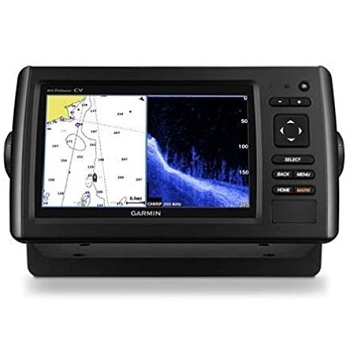 If you’ve been tossing and turning about what type of GPS chartplotter you should pick, perhaps you should look at the features of this one, too. In terms of accuracy and performance, it is very likely for this model to meet and even exceed your expectations.
It comes with a clear scanning sonar that shows you what’s happening in the water and even gives you photographic images of the water structures, objects, and fish. The CHIRP sonar that the gadget is outfitted with effectively sends out a continuous sweep of frequencies that provide you with all the info you need. It also creates accurate fish arches.
What’s also worth adding with regard to this device is that it comes preloaded with Blue Chart G2 charts for the coastal areas of the United States. The vast majority of the individuals that have decided to choose this product over the others say that it works well, it’s easy to use, and it comes with a sizable screen, too.
Pros
- Comfortable and convenient operation
- Both the depth finding and fish finding functions are easy
- You can install additional maps using the card slot
- The plastic mount feels solid
Cons
- Wiring with your VHF might be a little tricky, but do get in touch with the brand’s customer support for the task.
8. Simrad GO7 XSE Chartplotter/Fishfinder w/TotalScan
 This unit is a modern marine GPS that is also equipped with a chartplotter, as well as a fish finder. Having been designed by the professionals, the device provides you with accurate and crystal clear images, unlike some of the other traditional GPS units that are currently available.
The sizable 7-inch multi-touch display is definitely something worth writing home about and it facilitates a comfortable user experience. It’s intuitive and it ensures that you get the usability that you would benefit from if you were using a tablet or a smartphone.
What’s also worth noting about the GO7 is that it boasts waypoint management features, so that means that you can save your favorite spots and routes. It also supports a wide array of cartography systems from Insight Genesis and Navionics to NV Digital Charts and C-MAP.
The fact that it is also a bit more budget-friendly than many other units available in the same category is an advantage in itself.
Pros
- Doesn’t cost a fortune
- Comes with a sizable backlit display
- Has both chartplotting and fish finding capabilities
- Comes with everything you need in the box
- User-friendly and easy to customize
Cons
- When you go fast and then slow down, it takes 1 to 2 minutes for the unit to locate the depth and bottom again.
9. Garmin GPS MAP176C 3.8-Inch Waterproof Marine GPS and Chartplotter
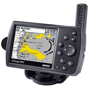 What seems to set this model aside from the rest is the fact that it is a little more basic. It mostly addresses the needs of boaters who aren’t even remotely interested in fishing, seeing how this unit doesn’t have any fish finding capabilities. It does come with a 12-channel receiver, though, and it displays accurate data pretty fast.
With the WAAS enabled, it can deliver all the info that you need to be able to locate yourself on the map in relation to various areas. Moreover, the MAP176C comes with an exclusive BlueChart marine cartography that is convenient, as well as reliable.
The only area where the Garmin model isn’t a winner is its display. As you might have been able to tell from the name, it comes with a backlit 3.8-inch screen that has a 16-color resolution of 320 x 240. This can be too little for some people, especially those who are accustomed with the resolution of their smartphone or tablet.
Pros
- Equipped with a built-in basemap of the Americas with rivers, lakes, US tide data, and even cities, highways, and interstates
- Over 3,000 waypoints and 50 reversible routes
- You can download maps from your computer to your GPS
- Comes with everything you need in the box
Cons
- The display could have been better.
What is a Marine Chartplotter?
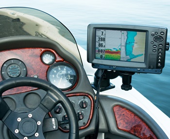 Many fishermen and women like to compare a marine chartplotter to a car GPS. These devices are ideal from many points of view, but especially for navigation. Some of them can be quite complex, meaning that you can use them as fish finders, too.
You don’t need a marine chartplotter if you do your fishing in small local waters, lakes, rivers, and a variety of other such places. You’d effectively waste your money on a device that would offer you hundreds, if not thousands of maps that you would never use.
The ideal user for a marine GPS chartplotter is someone that uses a large boat and it does so offshore. People who navigate in dark conditions, in poor weather, and last, but not least, water that’s big enough that you might get lost in it should rely on the use of a marine GPS chartplotter.
If you regularly perform ocean fishing, for example, you might need marine gear such as a trolling motor, a toddler swim vest, or even a set of marine solar panels to make sure that you have enough power to get you through your trip.
A chartplotter can be a friend in need if you need to do technical navigation, ocean fishing, as well as pathing.
Types of Chartplotters
 As you might expect, these devices vary a lot in terms of features. Almost every manufacturer has at least three models developed and that speak to different needs of boaters across the world. It is true that GPS chartplotters take the guesswork out of localizing yourself on a traditional map, but that’s not the only thing that they can do.
Here are some different types that you might want to look into depending on your specific requirements and expectations. Keep in mind that there are models that are versatile enough to boast all of these features, but they are some of the most expensive ones out there.
1. Standard GPS Chartplotters
GPS chartplotters are the typical model that you are likely to come across. As its name suggests, this type has navigational capabilities, but it’s sizable and can be mounted on pretty much any type of watercraft. We would advise against installing it on a kayak, though, since chartplotters are rarely useful in small waters such as rivers, for instance.
A GPS chartplotter usually comes with the ability to save waypoints and routes, it shows you plenty of maps, your location, and some even come with a built-in compass or a barometer.
2. GPS Chartplotters & Fish Finders Into One
As you might have guessed, these devices incorporate not just the standard characteristics of a GPS chartplotter, mostly relating to the navigation, but also the features of a typical fish finder.
What this means for you is that you’ll be able to consult the frequency and depth of the water you’re doing your fishing in, you’ll be able to visualize your potential catches, check out the temperature of the water, and a lot of other data. To be able to do their fish finding job, these chartplotters come with a transducer.
Fish are usually displayed as arches, so in terms of display and design, they’re not perfect — but they are helpful, especially for an experienced angler who has used such a device before. There are some fish finders out there that can display fish as actual fish, but they don’t have chartplotting capabilities, so you can’t get the best of both worlds.
3. Handheld Chartplotters
Compared to their bigger counterparts, handheld models can be a little basic, meaning that they come with a limited number of features. They do come with several maps, however, and the ability to locate you on the map, too, and some might even allow you to set your favorite routes or waypoints.
The most important aspect that you need to look at if you’re shopping for a handheld GPS chartplotter is its screen. The size of the display matters a lot, especially if you usually have a hard time looking at small numbers and letters. It also has to be backlit so that you can clearly visualize the data even when the sun is shining brightly in the sky.
4. Network Chartplotters
 If you opt for a device in this category, you will get not just the preloaded maps that it comes with, but also plenty of connectivity options. Some can connect to your WiFi or smartphone, in any case, so you can share your location with your fishing friends or family, if they’re worried about you being on the water for too long.
Depending on the place you are doing your fishing in, your network chartplotter can tell you whether you are bound to come across a potential danger.
There are some models out there that can display community-based information, which basically means that you can get alerts and notifications from fishers who are in the same geographic area or those that have devices made by the same brand.
5. Network Chartplotters & Fish Finders Into One
We’re pretty sure you were able to tell what these entail. They are the same as the devices that we have just described, but they also come with fish finding features such as water depth and temperature, side imaging, frequency selection, and others.
If you’re not just interested in boating for the fun of it and you’d also like to catch some fish while you are out on the water, this type of model can be a friend in need.
6. Autopilot Models
Of course it all boils down to your personal preferences and needs, especially when it comes to selecting the right GPS chartplotter for yourself. However, we couldn’t help noticing that some come with high-tech features such as autopilot controls, for instance.
A fully connected system can rely on auto-routing to enable you to point a spot on the display and then just see the plotter creating a route that is safe and hazard-free to get you to your destination as quickly and effectively as possible. That sounds pretty neat, right?
7. VHF & AIS
Both AIS and VHF work together and require a small aerial in order to transmit and receive and share the same antenna to tell you the data you need. While there are some units that don’t have AIS built-in, we don’t really recommend those as you will require an AIS processor separately.
The vast majority of boats out there incorporate a fixed VHF radio unit complete with a fist mic. Make sure that you find out whether the unit you are considering comes with an AIS processor or not.
Marine GPS Chartplotter Buying Guide
 Getting the right GPS chartplotter nowadays can be quite a challenge, and that’s why we decided to take some of the hassle out of your decision-making process and create a comprehensive guide. You’ll find all of the essential factors that you ought to take into account listed below, along with our explanations.
What kind of navigation can the marine GPS chartplotter provide you with? There are many devices these days that are capable of connecting to a sizable database so as to show you any location information.
Some of the units you will come across even come with an autopilot function, which can be quite helpful when it comes to plotting charts in a timely fashion.
The model should also be able to update its software automatically or you should be able to do that via a USB cable or other connectivity features. Smaller chartplotters typically require the data to be put in manually, so do get informed about that before you make your purchase.
2. Fishing Features
If you are keen on fishing, you will want to look for a GPS chartplotter that also comes with built-in angling features. Most models come with sonar and a variety of other fish-finding tools, all of which can be quite useful, especially for seasoned fishermen and women.
There are also chartplotters that can let you draw customized seabed maps so as to locate and relocate your favorite fishing places. Sonar features can make these units cost a pretty penny, so do consider whether this is something essential for you or you can do without it.
Also when it comes to the fishing capabilities of the device you will choose, you’ll have to check whether it comes with a transducer or not. While many include one, some don’t, so you’ll have to deal with the installation as best as possible on your own.
3. Racing Features
If you want to engage in boat racing, you should look for a chartplotter that comes with integrated features that can help you achieve just that. This usually means that with its assistance, you will keep track of your speed and time spent on the water.
Wind calculation is another characteristic that you might come across in such a unit, and it can help you move faster and make smart decisions, too. If you aren’t interested in racing, this is an inessential feature.
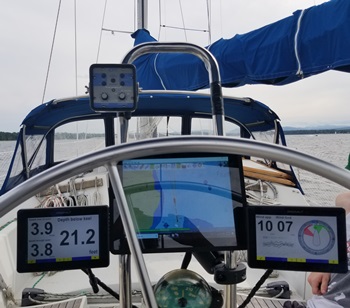
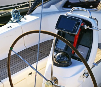
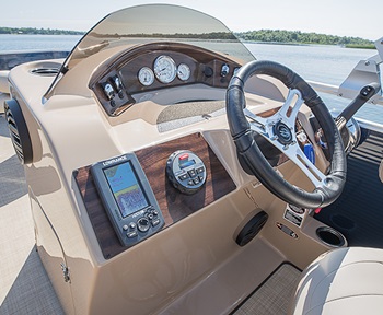
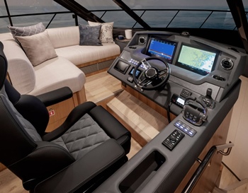
4. Display Dimension
The screen size matters quite a bit because if you have a hard time looking at small gadgets and seeing what is being displayed on them, you aren’t going to enjoy working with a small marine GPS chartplotter.
When choosing the screen dimension, the biggest factor to consider is the amount of detail that you need. Some chartplotters have two display screens or can at least allow you to split the display into two and use it for two different features.
If you want to get a GPS chartplotter and a fish finder into one, you should get the biggest screen size that you can afford. On a small screen, both the fishfinder and the map display could be so tiny that they might make it very hard, if not impossible for you to read the info.
Bigger screens tend to cost more than their smaller counterparts, so try to balance out your needs and budget as best as possible. We would also like to add that kayaks usually call for smaller chartplotters/fishfinders and that’s because bigger units might not fit in their consoles or be too bulky to be installed properly.
5. Buttons vs Touchscreen
 Most modern chartplotters now come with a touchscreen, which can be quite intuitive, especially if you are used to smartphones that boast the same feature. Unfortunately, touchscreens can be hard to use when you are constantly dealing with saltwater, rain, and the elements, in general.
Buttons can be more reliable than touchscreens, in this case, and believe it or not, they make it easier for manufacturing brands to make their devices waterproof. Touchscreens are a bit trickier in this respect. So, even if buttons are less intuitive and they can take longer to use, they are still dependable and will also impact the life of the product on the whole.
6. Connectivity
Chartplotters nowadays can come with many options when it comes to connecting to one or more other devices. Each of them is different, but here are some general ideas.
- WiFi
- Ethernet
- Bluetooth
- NMEA 0183
- NMEA 2000
NMEA 0183 is one of the oldest communication types. It’s done with cables, so that means that the chartplotter has to be physically wired to the other device you’re looking to connect to it.
NMEA 2000 connectivity is a bit newer and it offers wired connections to depth transducers, speed transducers, and other such devices. It doesn’t work with NMEA 0183.
WiFi and Bluetooth are obviously wireless, so they make it possible for chartplotters and fish finders to connect to each other much like phones and laptops or tablets and phones would be able to do. The vast majority of the modern chartplotters out there now come with a WiFi interface, so you can share the data onto your smartphone and from there, with a whole community.
Ethernet can sometimes be used alongside NMEA connectivity, but it is traditionally utilized for device-to-device connectivity for large data streams.
7. Ease of Use and Ease of Installation
Installing the chartplotter can be quite challenging, so when you are shopping for a device in this line, it is a good idea to read as many reviews of marine GPS chartplotters and see what other boaters have to say about usability and ease of installation.
Consider how much wiring you need so as to install the GPS module and also the number of sensors and accessories you will require. Small handheld units require less of an effort in this sense. The controls have to be as manageable as possible because otherwise, you will spend a lot of time trying to understand the information.
If at all possible, go to a store and have a talk with a consultant and ask for a demo session, if there is one available.
8. Storage
Storage is paramount when it comes to loading maps, charts, routes, locations, and any other data. With enough storage, you will be able to load everything you need, but if it is not sufficient, you aren’t going to be able to save new locations or use different maps.
Each chartplotter can have individual specifications in terms of how much memory storage it has onboard and how much you can add. Ideally, the unit should come with an SD or microSD card slot so that you can expand the internal storage. Just make sure that the device is compatible with bigger memory cards, too.
9. Sonar
If you want fish finding capabilities from your chartplotter, you have to look at the type of sonar that the device has been equipped with.
There are roughly three types of sonars available out there, and they can transmit different frequencies. A dual-frequency device is great if you tend to fish in both shallow and deep waters.
At a low CHIRP frequency, the signal is transmitted at 50 kHz or 25-80kHz, which should allow you to fish in deep waters. A medium CHIRP frequency is within the range of 80 to 160 kHz and it’s perfect for angling in shallow waters. A high CHIRP frequency will get you the best resolution and show you the depth and fish arches even when you’re sailing fast. This one, too, works best for deep waters.
10. Maps
The maps that the chartplotter comes with can mean a lot to an angler who isn’t keen on loading new ones right off the bat. Built-in maps can be a bit too general, but they can provide you with enough information to get your bearings.
Just make sure that the waters you intend to do your boating or fishing in are included in the maps that the device comes preloaded with. This will save you some time if you want to go out on the water right after receiving the unit, without bothering to load additional ones.
How to Install Marine Chartplotters?
 Every marine chartplotter is unique in its own way. Therefore, the installation process can vary largely from one model to the next. However, here are some generally universal guidelines that you should consider when setting up your unit for the first time.
- Pick the place where you want the chartplotter to be and make sure that it fits.
- After deciding on the perfect spot, drill several holes for the mounting studs (most chartplotters will call for four holes, one for every corner).
- Pass the cables of the chartplotter through the holes before you set it up in its final position.
- Reach behind and fix the thumb nuts so as to secure the chartplotter.
- Fasten the helm panel.
- Turn on the chartplotter.
- Insert a chart data card (if that’s required for the device to operate).
- Start navigating with your chartplotter.
FAQs About Marine GPS Chartplotters
1. How to Maintain Marine Chartplotters?
Cleaning and maintenance should be an important part of you taking care of the product so that it lasts for as long as possible. The screen needs to be cleaned with a soft cloth and a safe solution. Avoid abrasive, solvent-based, or chloride-based cleaners so as not to damage the screen.
Every once in a while, you should check whether the software is up to date. This can be done using a computer or laptop and connecting the device via USB or via WiFi, if your chartplotter has such connectivity features.
It’s a good idea to constantly check on the status of all of the components of the chartplotter, including the transducer. Finding damage can help you replace or repair all of the parts that might be faulty or that have stopped working ahead of time.
Get in touch with the manufacturing brand’s customer service for any issues regarding their return or refund policy and also make sure that the part you’re looking to replace is still being produced.
2. How to Use Marine GPS Chartplotters Safely?
Because they are so convenient and come with most of the info that you will need for safe, quick, and easy navigation, you can often find yourself relying on marine GPS chartplotters too much. The fact is that every boater should learn some navigation before he or she sets out on the water for the first time.
Here are some pieces of advice for using your GPS chartplotter in a safe way and for always finding your way.
- Make sure to update the device before setting sail.
- Learn to work with the interface of the unit as best as possible and read the manual to know what you can do if it shows you an error.
- Learn to understand all the symbols displayed on the screen and plot your course considering the number of hazards that you might encounter.
- If at all possible, plan your route before leaving on the trip. This will ensure that you don’t get distracted and end up desperately trying to get back on course.
- Get one of the models from our marine binoculars reviews to get your bearings live, not just digitally.
3. Is There a GPS for Boats?
A chartplotter is, in fact, a GPS, because it can display maps and it relies on the signal of satellites to localize you on that map. This can allow you to rest assured that you aren’t going to lose your way even when things get rough and the elements are not at your side.
Wrap Up
As you might have noticed, getting one of the best marine GPS chartplotters out there isn’t as easy as you might think. There are many things to consider before you decide on a unit, and since these devices aren’t the cheapest in the world, make sure you read as much about them before making your final decision.
As a last piece of advice, we’d like to suggest that you take the time to browse through as many marine GPS reviews as possible. Other boaters can let you know just how these devices perform in real life, how easy to use they are, or how difficult it’s been for them to install them.